Label Earth Features At Tectonic Plate Boundaries
Subject: Science
Grade: Seventh grade
Topic: Earth'S Features
Please LOG IN to download the presentation. Access is available to registered users only.
View More Content
Earth’s Features at Tectonic Plate Boundaries
– Our Dynamic Earth introduction
– Earth’s surface is constantly changing due to plate movements
– Tectonic Plates explained
– Large pieces of Earth’s crust that move over the mantle
– Interactions at plate boundaries
– Boundaries can form mountains, cause earthquakes, or create volcanoes
– Mapping Earth’s features
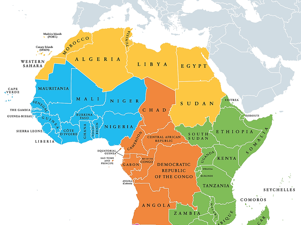
– Use maps to locate different features formed by plate interactions
|
This slide introduces students to the concept of tectonic plates and their role in shaping Earth’s surface features. Begin by explaining how the Earth is dynamic, with its surface continuously molded by the movement of tectonic plates. Clarify what tectonic plates are and how their movement affects the geography of our planet. Discuss the three types of plate boundaries: convergent, divergent, and transform, and the features each can create, such as mountain ranges, trenches, and fault lines. Encourage students to think about how these features impact life on Earth. As an activity, students can use maps to identify and label features like the Ring of Fire, the Mid-Atlantic Ridge, or the Himalayas, which are results of tectonic plate interactions.
Exploring Tectonic Plates
– Define tectonic plates
– Large pieces of Earth’s crust that fit together like a jigsaw puzzle
– Earth’s layers: Lithosphere & Asthenosphere
– Lithosphere: rigid outer layer. Asthenosphere: semi-fluid layer beneath
– Movement of tectonic plates
– Plates float on the asthenosphere, moving due to convection currents
– Impact on Earth’s features
– Plate movements shape mountains, volcanoes, and earthquakes
|
This slide introduces the concept of tectonic plates, the foundational pieces of the Earth’s crust that interact to shape the planet’s surface. The lithosphere and asthenosphere are defined to explain the structure of Earth’s layers and how they contribute to plate movement. Emphasize the dynamic nature of plate tectonics and how their movement can lead to the formation of various geological features and phenomena. Encourage students to think about how the Earth’s surface is constantly changing and the role that tectonic plates play in this process.
Tectonic Plate Boundaries and Earth’s Features
– Convergent boundary features
– Mountains, volcanoes, deep-sea trenches
– Divergent boundary features
– Mid-ocean ridges, rift valleys
– Transform boundary features
– Earthquakes, fault lines
|
This slide introduces students to the different types of tectonic plate boundaries and the Earth’s features associated with each. Convergent boundaries, where plates move towards each other, can form mountains, volcanoes, and deep-sea trenches. Divergent boundaries, where plates move apart, create features like mid-ocean ridges and rift valleys. Transform boundaries, where plates slide past one another, are characterized by earthquakes and fault lines. Encourage students to visualize these boundaries with real-world examples, such as the Himalayas for convergent boundaries, the Mid-Atlantic Ridge for divergent boundaries, and the San Andreas Fault for transform boundaries. This understanding is crucial for recognizing the dynamic nature of Earth’s surface.
Features at Convergent Boundaries
– Formation of Mountain Ranges
– Mountains form when two continental plates collide, e.g., the Himalayas
– Creation of Volcanic Arcs
– Volcanic arcs result from one oceanic plate subducting under another, e.g., the Andes
– Development of Ocean Trenches
– Deep underwater canyons created where one plate is forced under another, e.g., Mariana Trench
|
This slide focuses on the geological features formed at convergent plate boundaries, where two tectonic plates move towards each other. Mountain ranges such as the Himalayas are formed from the collision of continental plates. Volcanic arcs, like the Andes, occur when an oceanic plate subducts under a continental plate, leading to volcanic activity. Ocean trenches, exemplified by the Mariana Trench, are deep-sea trenches formed by the subduction of one plate beneath another. Encourage students to visualize these processes through diagrams and to understand the immense forces of Earth’s crust at work. Discuss the significance of these features in terms of Earth’s topography and ecosystems.
Features at Divergent Boundaries
– Discover Mid-Ocean Ridges
– Underwater mountain ranges formed by plate separation
– Explore Rift Valleys
– Deep valleys formed as tectonic plates move apart
– Understand Fissure Volcanoes
– Volcanoes with long cracks that emit lava during eruptions
|
This slide introduces students to the geological features commonly found at divergent tectonic plate boundaries. Mid-Ocean Ridges are underwater mountain ranges created by the upwelling of magma as tectonic plates move apart. Rift Valleys are significant depressions that can form on land or at the bottom of the ocean due to the diverging plates. Fissure Volcanoes are characterized by long cracks or fissures in the Earth’s crust through which lava erupts. These features are essential for understanding the dynamic nature of Earth’s crust and the role of plate tectonics in shaping our planet’s surface. Encourage students to think about how these features might look and what forces might be at work to create them. Provide visual aids or models if possible to help students visualize these structures.
Features at Transform Boundaries
– Understanding Fault Lines
– Fault lines are breaks in Earth’s crust where blocks of land move past each other.
– Earthquakes and their causes
– Sudden movements along fault lines can cause earthquakes.
– Recognizing Landscape Displacement
– Landscape displacement occurs when land moves along a fault.
– Impact on Earth’s surface
|
This slide aims to educate students on the geological features and phenomena associated with transform boundaries, where tectonic plates slide past one another. Fault lines are the locations at these boundaries and are crucial in understanding why earthquakes occur. When the stress on the rock is too great, it breaks, causing an earthquake. Landscape displacement is a visible indicator of this movement and can be seen in offset roads or streams. The impact of these features on Earth’s surface is significant and can alter landscapes over time. Encourage students to think of real-world examples of transform boundaries, such as the San Andreas Fault, and discuss the long-term effects of such plate movements.
Tectonic Plate Boundaries and Earth’s Features
– The Himalayas: Convergent Boundary
– Formed by the collision of the Indo-Australian and Eurasian plates.
– Mid-Atlantic Ridge: Divergent Boundary
– An underwater mountain range created by the separation of tectonic plates.
– San Andreas Fault: Transform Boundary
– A fault line in California where two plates slide past each other.
|
This slide presents real-world examples of Earth features formed at different types of tectonic plate boundaries. The Himalayas are a result of a convergent boundary, where the Indo-Australian Plate and the Eurasian Plate collide, pushing the land upwards to form mountains. The Mid-Atlantic Ridge is an example of a divergent boundary where the Eurasian and North American plates move apart, causing magma to rise and create new oceanic crust, forming an underwater mountain range. The San Andreas Fault exemplifies a transform boundary where the Pacific Plate and the North American Plate slide horizontally past each other, leading to earthquakes. Encourage students to research more examples and understand the geological processes at work.
Class Activity: Labeling Earth’s Features
– Identify features at plate boundaries
– Label the map with your partner
– Use the provided map of tectonic plates
– Discuss your findings with your partner
– Share ideas on how features are formed
– Complete the map together
– Ensure all features are labeled correctly
|
This activity is designed to apply students’ knowledge of tectonic plate boundaries and the Earth’s features associated with them. Provide a map with tectonic plate boundaries but without labels. Students should work in pairs to identify and label features such as mountains, volcanoes, earthquakes zones, and rift valleys. Encourage collaboration and discussion to foster a deeper understanding. As a teacher, circulate to guide and challenge students’ thinking. Possible variations of the activity could include using different maps, focusing on specific plate boundaries, or comparing and contrasting features at convergent versus divergent boundaries. Assess the completed maps for understanding and provide feedback.
Review: Earth’s Tectonic Features
– Recap of tectonic plate boundaries
– Open floor for questions
– Impact of features on Earth’s life
– Discuss volcanoes, earthquakes, and mountain formation
– Engage with interactive Q&A
– Use examples from class to prompt discussion
|
This slide aims to consolidate the students’ understanding of the day’s lesson on tectonic plate boundaries and their features. Begin with a brief review of the key concepts covered, such as the types of boundaries and the features they create. Encourage students to ask any questions they have, fostering an open and interactive environment. Highlight the significance of tectonic features on life on Earth, such as the creation of fertile lands by volcanic activity or the risks posed by earthquakes. Use this opportunity to assess student comprehension and clarify any misconceptions. The interactive Q&A session should involve real-life examples and encourage students to think critically about the impact of Earth’s geological features on their daily lives.
Homework: Explore Tectonic Features
– Research a tectonic feature
– Include feature’s location
– Is it at a divergent, convergent, or transform boundary?
– Describe the boundary type
– How does this boundary shape the Earth’s surface?
– Explain environmental impact
– Consider changes in landscape, ecosystems, or human activity
|
This homework assignment aims to deepen students’ understanding of the dynamic nature of Earth’s surface. Students are expected to select one tectonic feature, such as a mountain range, ocean trench, or volcano, and investigate its characteristics. They should specify the feature’s geographical location, identify the type of tectonic plate boundary it is associated with, and assess the impact this feature has on the surrounding environment, including both natural and human-induced changes. The report should be concise yet informative, and students should be ready to present their findings in the next science class. This will help them develop research skills and apply their knowledge of tectonic plates in a real-world context.

