Read A Map: Cardinal Directions
Subject: Social studies
Grade: Fourth grade
Topic: Maps
Please LOG IN to download the presentation. Access is available to registered users only.
View More Content
Welcome to the World of Maps!
– What is a map?
– A map is a drawing of the earth’s surface or part of it.
– Exploring map types
– Physical, political, climate, and more.
– Focus: Cardinal Directions
– North, South, East, West: guiding us on maps.
– Practice reading maps
|
This slide introduces students to the concept of maps and their importance in understanding the world. Begin by explaining what a map is and its role in representing the Earth’s surface. Discuss the different types of maps and their uses, such as physical maps showing landscapes, political maps showing boundaries, and climate maps showing weather patterns. Emphasize today’s lesson on cardinal directions, which are essential for navigation. Explain each direction and its significance. Engage the class with an activity where they practice using cardinal directions to locate places on a map, reinforcing their understanding of how to read a map effectively.
Understanding Cardinal Directions
– What are Cardinal Directions?
– The main directions: North, South, East, and West
– Remember: Never Eat Soggy Waffles
– A fun mnemonic to recall the directions
– Using Cardinal Directions daily
– Find places and navigate your neighborhood
– Why are they important?
– They help us describe locations and give directions
|
This slide introduces the concept of cardinal directions, which are the four main points of a compass. Teach students the names of these directions and use the mnemonic ‘Never Eat Soggy Waffles’ to help them remember the order. Discuss how we use these directions in everyday life, such as finding places on a map or explaining where something is located. Emphasize the importance of cardinal directions in navigation and geography. Encourage students to think of times they’ve used directions in their own lives and to practice using the mnemonic to point out the cardinal directions from their current location in the classroom.
Understanding the Compass Rose
– Parts of a Compass Rose
– The Compass Rose shows cardinal directions: North, East, South, West.
– Using a Compass Rose
– Locate the cardinal directions and use them to navigate on a map.
– Activity: Create a Compass Rose
– Draw and label a Compass Rose in your notebook.
|
This slide introduces the Compass Rose, a crucial tool for understanding map orientation and navigation. Begin by explaining the four main cardinal directions: North, East, South, and West. Demonstrate how to use these directions to find locations on a map. For the activity, provide students with a blank template or have them draw a Compass Rose in their notebooks, ensuring they label each direction correctly. This hands-on activity will help solidify their understanding of map reading. Offer guidance and support as needed, and encourage creativity in their designs. Prepare to display examples of Compass Roses from various maps in the next class to show different artistic interpretations.
Navigating with Cardinal Directions
– Find the Compass Rose
– It’s usually at the corner, showing North, South, East, West
– Determine directions between places
– Use the Compass Rose to see if you go up, down, left, or right on the map
– Example: School to Park route
– If the park is above the school on the map, we say it’s North
– Practice with different locations
|
This slide introduces students to using cardinal directions to navigate from one place to another on a map. Start by explaining the Compass Rose, a symbol that shows the four main directions. Then, guide students on how to use these directions to determine the route from one location to another, using their school and a nearby park as a relatable example. Encourage students to practice with different locations on various maps to solidify their understanding. As an activity, you can have students draw their own maps with a Compass Rose and create directions from one place to another.
Map Symbols and Legends
– Learn common map symbols
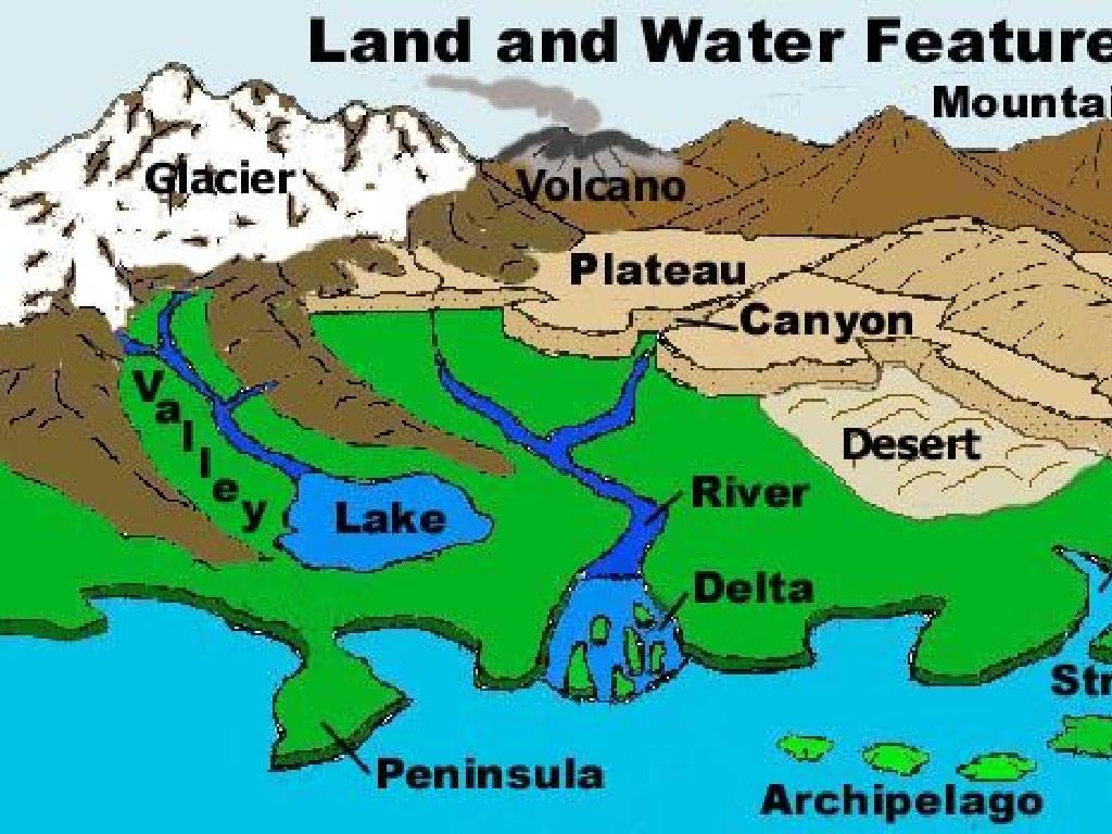
– Symbols represent features like rivers, mountains.
– Reading a map legend
– Legends explain what each symbol means.
– Activity: Matching symbols
– Match symbols on a legend to their meanings.
– Importance of map symbols
|
This slide introduces students to the basics of map symbols and legends, which are essential tools for understanding and interpreting maps. Begin by explaining that map symbols are small pictures that represent different features on a map, such as rivers, mountains, and cities. Then, show how a legend, or key, defines what each symbol stands for. For the activity, provide students with a worksheet that has common map symbols and a blank legend for them to fill in the correct meanings. This will help reinforce their learning and ensure they can apply this knowledge when reading any map. Discuss the importance of these elements in navigation and understanding geographical information. Encourage students to share any symbols they already know and to think about why clear symbols are important for map readers.
Practice Time: Cardinal Directions
– Understanding Cardinal Directions
– Class Activity: Map Navigation
– Use a school map to find locations using North, East, South, West
– Example: Library to Cafeteria
– If the cafeteria is east of the library, we go east to get there
– Share your findings with the class
|
This slide is designed to engage students in a practical activity to solidify their understanding of cardinal directions. Provide each student with a simple map of the school, or create a fictional map with various landmarks. Students will use the map to determine the cardinal directions from one point to another, such as from the library to the cafeteria. Encourage them to think about where they would face when standing at the library and which way they would turn. After the activity, ask students to share their answers and explain their reasoning. Possible variations of the activity could include navigating from the playground to the office or from the gym to the science lab, ensuring that students get practice with all four cardinal directions.
Class Activity: Map Making with Cardinal Directions
– Draw a map of your classroom or school
– Include a Compass Rose
– Shows North, East, South, West on your map
– Add a map legend
– Explains symbols and colors used
– Use Cardinal Directions for 5 locations
– For example: The library is north of the cafeteria
|
This activity is designed to help students apply their knowledge of cardinal directions by creating a map of a familiar place. Provide students with paper and coloring materials. Remind them to draw a simple layout of the classroom or school, and to include a compass rose to indicate directions. They should also create a legend that explains what different symbols on their map represent. Encourage them to think spatially about where things are located and to use the cardinal directions to describe the location of at least five items or places on their map. This hands-on activity will reinforce their understanding of maps and how to use them to navigate spaces.
Review: Cardinal Directions & Compass Use
– Recap cardinal directions
– North, East, South, West are main directions
– Importance of cardinal directions
– They help us navigate and find places
– Using a Compass Rose
– It shows directions on a map to guide us
– Q&A session
|
Begin the slide by recapping the four cardinal directions: North, East, South, and West. Emphasize their importance in everyday navigation and how they help us locate places on a map. Review the use of a Compass Rose, which is a symbol on a map that displays the cardinal directions and is used to orient the map properly. After the review, open the floor for any questions the students may have. This will help clarify any doubts and reinforce their understanding. Encourage students to ask questions about anything they find confusing or want to explore further. Be prepared with additional examples or activities in case there are no immediate questions from the students.
Map Reading Mastery & Homework
– Congratulations on learning map reading!
– Homework: Map your town journey
– Find a map of your town and plan a route
– Use Cardinal Directions from home
– Remember: North, East, South, West
– Share your findings in class
– Tell us how you used the directions
|
Well done to the students for their hard work in learning how to read a map and understand cardinal directions. For homework, they are tasked with applying these skills practically by using a map of their own town. They should identify a route from their home to their favorite place using the cardinal directions. This exercise will reinforce their understanding and give them a real-world application of the lesson. Encourage them to be prepared to discuss their route and how they determined the directions in the next class, fostering a discussion on practical navigation.


