Oceans And Continents
Subject: Social studies
Grade: Eighth grade
Topic: Physical Geography
Please LOG IN to download the presentation. Access is available to registered users only.
View More Content
Exploring Oceans and Continents
– What is Physical Geography?
– Earth’s surface composition
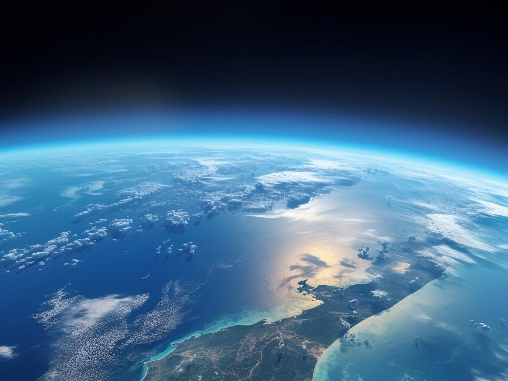
– Earth’s surface is 70% water and 30% land
– Oceans: Earth’s bodies of water
– Five major oceans: Pacific, Atlantic, Indian, Southern, Arctic
– Continents: Earth’s landmasses
– Seven continents: Asia, Africa, North America, South America, Antarctica, Europe, Australia
|
This slide introduces students to the basics of Physical Geography with a focus on understanding the Earth’s surface, particularly the oceans and continents. Physical Geography is the branch of geography dealing with natural features and processes. It’s important to highlight that the Earth’s surface is predominantly water, with five major oceans that cover it. Each ocean has its unique characteristics and significance. Similarly, the seven continents, which are vast landmasses, have their own diverse climates, cultures, and ecosystems. Encourage students to think about how oceans and continents affect climate, weather patterns, and human life. This will set the stage for more in-depth discussions on each of the Earth’s major bodies of water and landforms in subsequent lessons.
Exploring Physical Geography
– Defining Physical Geography
– Earth’s natural features
– Includes mountains, rivers, deserts, and more
– Elements of Physical Geography
– Study of landforms, climates, ecosystems, and water bodies
– Its role in our understanding
– Helps explain Earth’s processes and human impacts
|
Physical Geography is a branch of geography that deals with the study of the natural features and phenomena on the Earth’s surface. It encompasses the analysis of landforms, climate patterns, vegetation, and bodies of water, which are all integral to understanding the physical layout and processes of our planet. Emphasize the importance of this field in providing insights into how these natural elements interact and affect human life. Discuss how it helps us to predict weather patterns, manage natural resources, and plan sustainable development. Encourage students to think about how physical geography affects their daily lives and the environment.
Mapping Our World: Continents & Oceans
– The seven continents
– Asia, Africa, North America, South America, Antarctica, Europe, Australia
– The five oceans
– Pacific, Atlantic, Indian, Southern, Arctic
– Identifying continents on a map
– Look for large landmasses separated by water
– Identifying oceans on a map
– Look for vast water bodies between landmasses
|
This slide introduces students to the basics of world geography, focusing on the seven continents and five oceans. It’s crucial for students to recognize these fundamental components of our planet. When identifying continents and oceans on a map, students should look for the distinguishing features of each continent such as shape and relative position, as well as the surrounding oceans. Encourage students to use color-coded maps to differentiate between land and water. This knowledge serves as a foundation for understanding global geography, climate, culture, and political boundaries. As an activity, students can label a blank map with the continents and oceans to reinforce their learning.
Exploring Earth’s Continents
– Characteristics of continents
– Each continent has its own climate, culture, and biodiversity.
– Ranking continents by size
– Asia is the largest, while Australia is the smallest continent by land area.
– Unique continental features
– Africa’s Sahara, South America’s Amazon, Asia’s Mount Everest, etc.
– Fascinating continent facts
– Did you know Asia is the most populous continent?
|
This slide aims to provide an overview of the Earth’s continents, highlighting their distinct characteristics, relative sizes, and unique features. When discussing characteristics, focus on the diverse climates, cultures, and biodiversity found on each continent. Emphasize the size differences by ranking them from largest to smallest, which can be a great visual exercise if accompanied by a map. Unique features should include geographical landmarks, ecosystems, and natural wonders that are iconic to each continent. Lastly, share interesting facts such as population statistics, historical tidbits, or record-setting features to engage the students’ curiosity and encourage further exploration of each continent’s identity.
Oceans: Earth’s Vast Bodies of Water
– What defines an ocean?
– An ocean is a large body of salt water that covers most of Earth.
– Oceans vs. seas: What’s the difference?
– Seas are smaller and partially enclosed by land.
– Oceans’ role in Earth’s climate
– Oceans regulate temperature and weather patterns.
– Oceans’ impact on human life
– They provide food, transportation routes, and recreation.
|
This slide introduces students to the concept of oceans and their importance to our planet and our lives. Begin by defining an ocean and comparing it to seas, highlighting size and geographical differences. Discuss how oceans contribute to climate regulation through currents and heat distribution. Emphasize the critical role oceans play in supporting human life by providing resources, influencing weather and climate, and offering economic opportunities. Encourage students to think about how oceans affect their daily weather and global environmental systems.
Tectonic Plates and Earth’s Geography
– Tectonic plates shape continents
– Earth’s crust is divided into large plates whose interactions form continents and oceans.
– Plate tectonics: Earth’s geology
– Plate tectonics is the process explaining how plates move and interact.
– Movement of plates and features
– Plate movements can lead to earthquakes, volcanic activity, and mountain building.
– Impact on continents and oceans
– These movements have created the continents and oceans as we know them today.
|
This slide introduces the concept of tectonic plates and their significant role in forming the Earth’s physical features, including continents and oceans. Tectonic plates are massive slabs of Earth’s crust that float on the semi-fluid mantle. The theory of plate tectonics explains the movement of these plates and the resulting geological activities such as earthquakes, volcanic eruptions, and the creation of mountain ranges. Understanding plate tectonics is crucial for students as it provides insight into the dynamic nature of our planet and explains the distribution and physical features of continents and oceans. Encourage students to consider how the slow but powerful movements of tectonic plates have shaped the world we live in over millions of years.
Exploring the Ocean Floor
– Ocean floor’s diverse topography
– Features mountains, valleys, and plains, much like dry land.
– Mariana Trench: Earth’s deepest point
– Located in the Pacific Ocean, it’s deeper than Mt. Everest is tall.
– Hydrothermal vents: Oases of life
– These underwater geysers support life in extreme conditions.
– Unique ecosystems of the deep
– Specially adapted creatures thrive without sunlight.
|
This slide aims to introduce students to the complex and varied landscape of the ocean floor, which mirrors terrestrial geography with its own mountains, valleys, and plains. Highlight the Mariana Trench as the most profound example of oceanic depth. Discuss hydrothermal vents, which are hot springs on the ocean floor that support unique ecosystems, providing energy in a sunless environment. Emphasize the adaptability of life forms in these extreme conditions and how they contribute to our understanding of biology and geology. Encourage students to think about how these features compare to familiar landscapes on land and the importance of preserving these unique underwater habitats.
Human Impact on Oceans and Continents
– Ocean pollution effects
– Toxins harm marine life, disrupt ecosystems
– Deforestation impacts
– Loss of habitats, biodiversity, affects climate
– Conservation efforts
– Initiatives like protected areas, sustainable practices
– Protecting our planet
|
This slide aims to educate students on the significant human impacts on the Earth’s physical geography, particularly oceans and continents. Discuss how pollution, especially plastics and chemicals, affects marine life and oceanic ecosystems. Explain deforestation’s role in habitat loss, decreased biodiversity, and climate change. Highlight conservation efforts, such as establishing protected areas and promoting sustainable resource use, to mitigate these impacts. Emphasize the importance of individual and collective actions to preserve our planet’s geography for future generations. Engage students by discussing local conservation projects or global initiatives they can participate in.
Class Activity: Create Your World Map
– Draw and label continents and oceans
– Mark significant physical features
– Include features like the Himalayas or the Amazon River
– Share one geography fact with the class
– Maybe a unique landform or cultural aspect of a region
– Present your map to your peers
|
This activity is designed to engage students with hands-on learning and to deepen their understanding of world geography. Provide students with the necessary materials such as blank maps, markers, and atlases. Encourage them to accurately draw and label each continent and ocean. They should also mark and name at least five significant physical features, such as the Rocky Mountains, Sahara Desert, or Nile River. Each student will choose one interesting geographical fact about a location on their map to share with the class. This could be related to the physical landscape, climate, or cultural geography. Possible activities for different students could include focusing on different continents, comparing and contrasting two regions, or researching the impact of geographical features on human settlement. The presentation aspect will help students practice public speaking and information synthesis.


